Carolina Public Press – Ridge Law story part 2


sugar-top-2-1-610x403Photo: Max Cooper

This is part 2 of my story on the ridge law in Carolina Public Press (also on the front page of the Charlotte Observer web-site this morning):

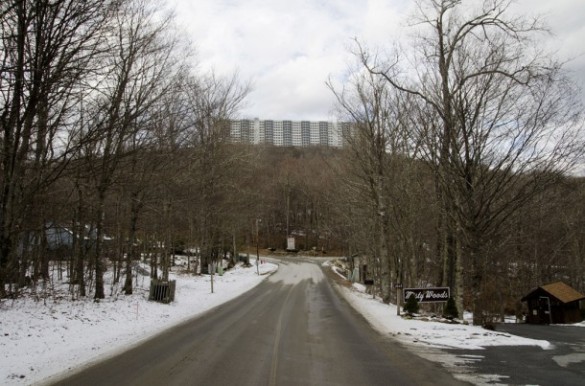
On a blustery November afternoon, there are no views from the 5,000-foot summit of Little Sugar Mountain in Avery County. Situated on the knob is Sugar Top, the 10-story steel-and-concrete structure is veiled in a blanket of fog. Three decades ago, the construction of this very building launched a public debate on how the state should protect one of its most valuable resources: mountain views.

Ironically, the legislation this high-rise inspired — the Mountain Ridge Protection Act (of 1983), which banned certain tall buildings on ridge lines above 3,000 feet — gave Sugar Top an exclusive mountain apex location, making it an even easier sell by its developer, the Columbia, S.C.-based developer U.S. Capital Corp.

“Not much said about Sugar Top in the press has ever been positive,” said Dennis Lacey that November day. General manager of the building’s condominium association, Lacey is also a long-time resident of Sugar Top and the village of Sugar Mountain’s mayor.


Thirty years later: North Carolina Mountain Ridge Protection Act of 1983

sugar-top2-610x403

(photo: Max Cooper)

This is part 1 of my reporting on the North Carolina Mountain Ridge Protection Act in Carolina Public Press:

Three decades ago, the weather in the last days of 1983 in North Carolina was particularly fierce. So cold and windy, in fact, that The Charlotte Observer reported 20 degrees-and-below temperatures and widespread electrical outages in Avery County.

Among the victims were condominiums sitting atop Avery County’s Little Sugar Mountain, where pipes burst, sending water to soak some of the recently completed units in perhaps the most well known – and arguably notorious – structure in the North Carolina mountains.

Just days after that blast of winter weather, the landmark Mountain Ridge Protection Act (of 1983) enacted by the N.C. General Assembly went into effect on Jan. 1, 1984.

Yet, the months leading up to the law’s passage were as fierce as the winter cold. But during that ferocity, which led to the subsequent passage of the law, the public movement to protect ridge tops established a hard-fought, but shared, point of view among North Carolinians: the scenic value of high mountain vistas are too valuable to spoil.


Carolina Public Press: Reporting on Pisgah/Nantahala National Forest plan revision Part II

JoyceKilmer-610x457

For part II of my reporting on the Pisgah/Nantahala national forest plan revision link here:

The hike to Snooks Nose — an overlook from a narrow rocky ridge in the Curtis Creek watershed near Marion in McDowell County — is for the most part, unremarkable. The short, far-flung footpath is overgrown, steep and deeply rutted in places. What does distinguish this route is its location. The watershed in which it meanders is the first parcel of forest protected by Uncle Sam east of the Mississippi more than a century ago.

The Weeks Act, federal legislation signed into law by President Howard Taft in 1911 gave the U.S. government the ability to purchase private land from willing sellers in order to protect the headwaters of rivers and watersheds in the East. Beginning with the 8,100 acre Curtis Creek purchase in 1911 from the Burke McDowell Lumber Company, the federal government ultimately protected 1.25 million acres of forest land in the Southern Appalachians — an area the size of the state of Delaware – by 1918.

Carolina Public Press: Reporting on Pisgah/Nantahala National Forest plan revision – Part I

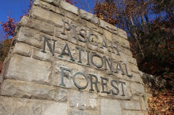
Pisgah-national-forest-monument-610x406

Link here for part 1 of my reporting on the Pisgah/Nantahala national forest plan revision.

In 1911, the U.S. government purchased 8,100 acres in McDowell County to protect forest land in the Curtis Creek watershed near Marion. It was the first of many land swaps in the region that eventually formed two national forests and added more than 1 million acres to the public domain spanning 18 counties in Western North Carolina.

For the first time since 1994, the public now has the opportunity to influence how that federal forest land — now known as the Nantahala and Pisgah national forests — will be managed for the next 15 years.

Jack Igelman

South Carolina Wildlife magazine: A Fighting Chance for Wildlife

SO13-19digLive-S-Rikard


Wildlife manager Doug Morrow stands among century-old longleaf pines explaining why the Southeastern kestrel — a subspecies of the American kestrel — prefers mature, open pine woodlands. Without breaking stride, he bends over a tubular plant known regionally as frog’s britches, describing how it digests insects. It’s evident that he’s right at home here in the sandy hills east of Columbia, yet Morrow is standing smack dab in the middle of an army base on a tract of forest land adjacent to an active firing range.

Morrow’s in charge of wildlife and habitat conservation efforts for the Environmental Division at the U.S. Army’s Fort Jackson training facility. Although a civilian employee, Morrow’s rapid fire of acronyms — DOD, RCW, ESA, DNR, MAPS — provides unmistakable evidence of the military influence that’s governed his twenty-five years on base, where he also shares the Army’s primary mission: training soldiers to fight and win wars.

Jack Igelman

Link to this article in Wildlife in South Carolina

WNC Magazine Hike: Gorges State Park – Rainbow Falls

rainbow-falls-trail-main

Length: 3 miles

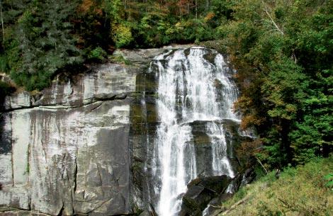
Rainbow Falls may be just one of dozens of five-star waterfalls gushing through the steep canyons of the Jocassee Gorges, but this one doesn’t require an all-day hike. The short trek will give hikers a taste of the remoteness and sensational topography of the Blue Ridge escarpment—the wall of mountains that separates the high country from the Piedmont. The 7,500-acre Gorges State Park, established in 1999, protects one of the most remarkable regions of the state and portions of the seven headwaters that burst through sheer terrain to form Lake Jocassee.

Begin the hike just beyond the park’s new visitor center at Grassy Ridge parking area. Roughly a quarter mile from the trailhead, turn right on the orange blaze trail and descend the wide gravel footpath. Eventually, the trail crosses into Nantahala National Forest and meets the Horsepasture River, where it turns upstream toward the roar of the falls. Around a bend, you’ll be greeted by the refreshing mist of the spectacular cascade plummeting over a cliff, which is bordered by steep forested ridges. Cool off at a viewing area near the base of the falls or follow the stairs to the source. Backtrack to complete the trip.

Navigate: From Sapphire, follow N.C. 281 south for just less than a mile to Gorges State Park. Enter the park and bear right past the visitor center to the parking area.

Jack Igelman

WNC Magazine Hike: Appalachian Trail – Sams Gap to High Rock

samsrockmain

Difficulty: Moderate
Round-Trip: 3 miles

Awe-inducing vistas aren’t difficult to find in Western North Carolina; the bigger challenge is finding secluded overlooks. A lovely hike along a seldom-used section of the Appalachian Trail in the Bald Mountains hits both criteria. The trailhead, within view of Interstate 26, is also easy to access. The footpath winds through a mature ridgetop forest, alongside bygone grazing land, and ends with a lofty view from a tucked-away perch.

To begin the hike from the Sams Gap parking lot near Mars Hill, walk under the interstate, then go left up the steep road. In roughly 75 yards, turn left on the trail marked by the fenced gauging station and Appalachian Trail marker. Follow it along a ridgetop that straddles the North Carolina-Tennessee state line. In sections, the going is steep. After a mile, pass through a series of small gaps to continue the climb. Once the trail levels, look for a sign that reads “Vista 200 ft.” nailed to a tree on the right. Squeeze through a narrow gap in the trees to reach High Rock at nearly 4,500 feet. The craggy outcrop is just large enough for two to take in the grand view, ensuring a peaceful reward.

Navigate: From Mars Hill, go west on I-26. Take Exit 3, then turn left on U.S. 23A. In roughly three miles, park in the lot on the left before the I-26 overpass at Sams Gap.

Jack Igelman

WNC Magazine Hike: Lake Shore Trail, GSMNP

lakeshore trail

The footpath winds through a remote section of terrain along the shoreline of Lake Fontana. In the 1940s, hundreds of families were relocated to make way for the creation of the lake and expansion of the park. Signs of their former homesteads scattered along the way make this route a lure for nature lovers and history buffs.

You don’t have to conquer the entire length to get a taste of the hike’s beauty and history. To reach the route, pass through or around the tunnel that marks the end of Lakeview Drive, aka the Road to Nowhere. From the tunnel, walk roughly two miles along Lakeshore Trail and pass the Whiteoak Branch Trail junction. Continue west and pass an old overgrown homestead, soon crossing Gray Wolf Creek. Upstream, a maintained road grade leads to Woody Cemetery, one of several dozen eternal resting places along the north shore still maintained by the National Park Service. Take a side trip to view the orderly rows of hand-chiseled tombstones that have been dulled by the elements over the years. Continue to scenic Forney Creek at mile three and then retrace your steps.


Difficulty: Moderate
Round-Trip: 6 miles


Navigate: From Bryson City, follow Everett Street northwest. The route becomes Lakeview Drive. In roughly 10 miles, the byway ends at the tunnel. Park on the right.

Jack Igelman

WNC Magazine Hike: Perry Cover Trail, Pisgah National Forest

perrycovemain

A benefit of hiking in wintertime is taking in eye-popping views under crystal clear skies. For a short route with a great payoff, walk the Perry Cove Trail in Pisgah National Forest.

The jackpot for hikers is a scenic trifecta of Pisgah’s most famous granite domes.

From the Pisgah Forest Stables, walk a tenth of a mile to Forest Service Road 5054. It’s a short walk to reach Perry Cove Trail on the right. The path meanders to Saddle Gap through an open section of cove forest. In 1.2 miles, turn right on Bennett Gap Trail and walk along a ridgeline buffered by a stand of rhododendron and mountain laurel. Ascend and wind through several rock steps, and in less than a half mile, look left for a world-class view. To the west and nestled among wooded ridges is humble John Rock, and several ridges beyond is the multitiered Cedar Rock. But the scenic plunder is the north side of Looking Glass, an aged glob of hardened lava.

To complete the trek, retrace your steps. Or, continue on Bennett Gap Trail for a slightly longer loop. Turn left at Forest Service Road 477, and reach the riding stables in a half mile.

Navigate: From the intersection of U.S. 276 and 64 near Brevard, drive 2 miles and turn right on FSR 477. Reach the stables in 2 miles. The trailhead is beyond the stables on the left.

Jack Igelman